
Google Earth VR offers a unique and immersive way to explore the world from the comfort of your own home. Leveraging Google’s extensive Earth API and years of 3D imagery collection, this application transforms your virtual reality headset into a portal to virtually any location on the globe. This detailed exploration goes beyond simply viewing static images; it provides an interactive, three-dimensional experience that allows users to fly through cityscapes, soar over sprawling landscapes, and explore famous landmarks in unprecedented detail.
A First-Person Perspective on Global Exploration
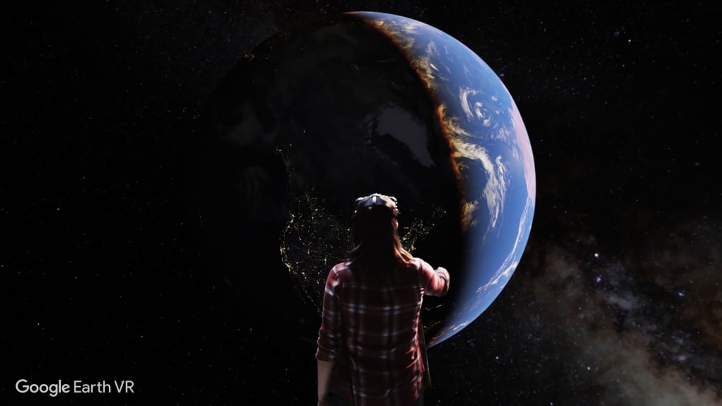
Unlike traditional Google Earth, which primarily presents a two-dimensional map view, Google Earth VR places you directly within the virtual environment. This first-person perspective radically changes the experience, providing a sense of presence and scale that static images or even traditional 3D models cannot replicate. You are not just observing a location; you are in it, able to freely navigate and explore at your own pace. This immersive quality transforms the act of exploring the Earth into an engaging and captivating adventure.
The control scheme is intuitive and well-designed, making navigation a seamless experience. While specific controls vary depending on your VR headset, the overall principle remains consistent: effortless movement and exploration through a vast virtual landscape. Whether you prefer a gentle flight over serene countryside or a thrilling swoop through bustling city streets, Google Earth VR provides the tools for immersive, personalized exploration.
Immersive Detail and Realistic Environments
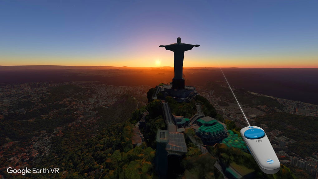
Google Earth VR boasts an impressive level of detail, particularly in highly populated urban areas. Major cities are rendered with remarkable fidelity, capturing the intricate layouts of streets, the shapes of buildings, and even the textures of surfaces. You can virtually walk down famous streets, admire iconic structures from unique angles, and gain a profound sense of place. However, it’s important to note that rendering quality can vary across different regions. While highly populated areas typically benefit from the most detailed rendering, less populated areas might appear less refined, requiring more time to fully load and potentially showing a lower level of detail. This is not a limitation unique to Google Earth VR; it reflects the inherent challenges of rendering vast, geographically diverse areas in a real-time virtual environment.
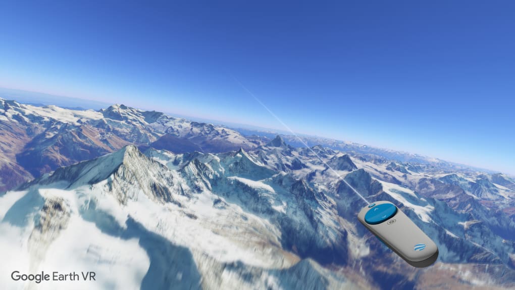
The realistic rendering extends beyond simply visual details. The subtle variations in light and shadow, the realistic depiction of vegetation, and the sense of depth and scale all contribute to creating an incredibly believable and immersive virtual world. This realism is a key element in making Google Earth VR an engaging and captivating experience for users. The sensation of flying above the Earth, observing the diverse terrains and human settlements, is a compelling demonstration of the power of virtual reality technology to offer unique perspectives and enhance our understanding of the planet.
Beyond Sightseeing: Exploring the Features of Google Earth VR
Google Earth VR is not just a virtual sightseeing tool; it’s a multifaceted application offering a range of features designed to enhance exploration and discovery. Beyond the core functionality of navigating and exploring various locations, the application incorporates several features that improve the user experience. These features are designed to enhance the overall interaction and make the experience more enriching and informative.
One notable feature is the ability to seamlessly transition between different viewpoints and perspectives. You can effortlessly switch from a bird’s-eye view to street level, exploring the intricacies of a cityscape or the vast expanse of a natural landscape. This flexibility allows for a multifaceted exploration of any given location, providing a richer and more comprehensive understanding. Another significant enhancement is the ability to easily share your virtual explorations with others. Whether it’s capturing stunning screenshots to share with friends or broadcasting your virtual journeys in real-time, Google Earth VR provides multiple avenues for sharing the experience. The integration of these communication tools adds another layer to the application, allowing for collaboration and shared discovery, fostering a sense of community among users.
The Technological Underpinnings of Google Earth VR
Google Earth VR’s impressive visual fidelity and immersive experience are built upon a foundation of sophisticated technology. Years of data collection and the development of advanced rendering techniques have been crucial to the application’s success. Google’s extensive archive of 3D imagery, collected through satellite imagery, aerial photography, and street-level imagery, provides the raw material for the detailed virtual environments. This immense dataset is processed using sophisticated algorithms to create seamless and consistent virtual worlds.
The rendering engine employed by Google Earth VR is optimized for virtual reality headsets, ensuring smooth and responsive navigation even in complex virtual environments. The ability to seamlessly navigate large-scale environments without significant performance issues is a testament to the application’s robust technological underpinnings. The integration of real-time rendering and optimized data streaming ensures a smooth and consistent experience, minimizing interruptions and maintaining a sense of immersion. The constant evolution of the underlying technology further enhances the capabilities of the application, allowing for consistent improvements in visual quality and performance.
Google Earth VR: A Platform for Exploration and Education
Google Earth VR is more than just a visually stunning application; it’s a platform for exploration, education, and shared experiences. Its capacity to transport users to any corner of the globe offers a multitude of educational possibilities. Students can explore historical sites, study geographical formations, and learn about different cultures from unique perspectives. The immersive nature of the experience fosters a deeper understanding and appreciation of the world’s diversity. Moreover, the application’s potential extends beyond individual exploration. The capacity for shared experiences and collaboration offers exciting possibilities for group learning and virtual field trips.
Google Earth VR represents a significant advancement in the field of virtual reality applications. It demonstrates the potential of VR technology to enhance our understanding of the world and to foster deeper engagement with geographical information. The immersive experience, coupled with its educational potential, positions Google Earth VR as a powerful tool for exploration and learning. Furthermore, its accessible nature and intuitive interface makes it suitable for users of all ages and technical proficiency.
A Comparison with Traditional Google Earth
While Google Earth VR builds upon the foundation of Google Earth, it offers a distinct and fundamentally different user experience. Traditional Google Earth provides a two-dimensional map interface, allowing for exploration through panning, zooming, and searching. It’s a powerful tool for accessing geographical information and planning journeys, but its visual representation is limited. Google Earth VR, on the other hand, offers a completely immersive, three-dimensional experience that places the user directly within the virtual environment. The change from a two-dimensional interface to a fully immersive VR experience significantly alters how users interact with and understand geographical data. This difference highlights the transformative potential of VR technology and its capacity to enhance our engagement with geographical information.
The choice between Google Earth and Google Earth VR ultimately depends on the user’s needs and preferences. For users seeking a comprehensive, feature-rich map application with a vast array of data, traditional Google Earth remains a powerful tool. However, for those who prioritize an immersive and visually engaging experience, Google Earth VR offers a compelling alternative that provides unique perspectives and opportunities for exploration.
Conclusion: The Future of Virtual Exploration
Google Earth VR represents a significant milestone in virtual reality technology and its application to geographical exploration. Its immersive environment, detailed visuals, and intuitive interface create an unparalleled experience for users, transforming the act of exploring our planet into an engaging and informative journey. While challenges remain, such as improving rendering quality in less densely populated areas, Google Earth VR’s current capabilities are impressive. Its ability to provide a unique and immersive perspective on our planet sets a new standard for virtual exploration applications, paving the way for future developments in virtual tourism, education, and environmental awareness. The application’s ongoing development and the continuous improvement of VR technology promise an even more detailed and immersive experience in the years to come, further blurring the lines between the virtual and the real. The future of exploring our planet may well be more virtual than we ever imagined.
File Information
- License: “Full”
- Latest update: “January 31, 2023”
- Platform: “Windows”
- OS: “Windows 7”
- Language: “English”
- Downloads: “44.6K”


